NEWS


Monitoring Recreational Fishing from Space
27/08/2025
Recreational fishing is widespread across coastal areas, but monitoring these activities remains a challenge, as small boats are not required to carry tracking systems such as AIS (Automatic Identification System).
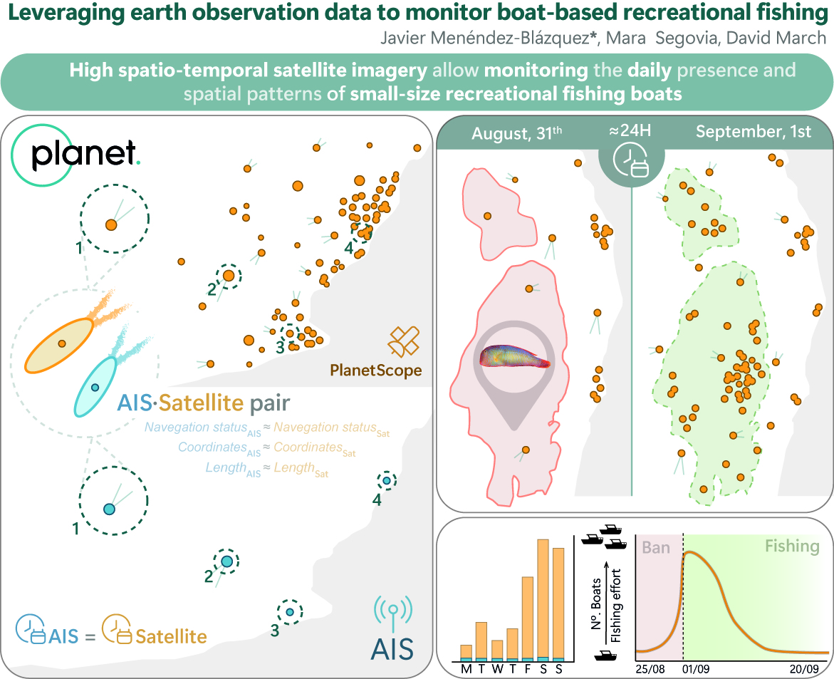
A recent study published in Fish and Fisheries and led by Spatial Marine Lab members (Javier Menéndez-Blázquez, Mara Segovia and Dr. David March), has demonstrated how high spatial and temporal resolution satellite imagery can offer a reliable solution for monitoring recreational fishing. Researchers assessed the potential of satellites to detect daily changes in boat activity during a temporal fishing ban within a marine protected area.
The study showed that AIS (Automatic Identification System) detected only about 5% of the boats identified through satellite imagery, underscoring the significant limitations of conventional tracking systems. The results show that satellites not only captured boat activity that AIS missed, but also revealed a clear increase in fishing effort immediately after the ban was lifted.
These findings emphasize the power of satellite technology to monitor small-scale fishing fleets, providing fine-scale spatio-temporal information that can support ecosystem-based management and marine spatial planning. When combined with local knowledge, this approach enhances our ability to understand and manage recreational fisheries more effectively.
For more details, you can access the full open-access publication here:
Menéndez-Blázquez, J., Segovia M and March D. 2025. Leveraging Earth Observation Data to Monitor Boat-Based Recreational Fishing. Fish and Fisheries 1–10.
Post pictures credits
· PlanetScope scene (Planet Labs PBC).
· Study visual abstract (Javier Menéndez-Blázquez, CC-BY)
Posted by:

Javier Menéndez-Blázquez
PhD Student
